


PRAIRIE TWP Voting District, Davis County, Iowa
About
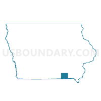
Outline

Summary
| Unique Area Identifier | 581936 |
| Name | PRAIRIE TWP Voting District |
| County | Davis County |
| State | Iowa |
| Area (square miles) | 27.63 |
| Land Area (square miles) | 27.48 |
| Water Area (square miles) | 0.15 |
| % of Land Area | 99.45 |
| % of Water Area | 0.55 |
| Latitude of the Internal Point | 40.69252080 |
| Longtitude of the Internal Point | -92.22367420 |
Maps


Graphs
Select a template below for downloading or customizing gragh for PRAIRIE TWP Voting District, Davis County, Iowa


Neighbors
Neighoring Voting District (by Name) Neighboring Voting District on the Map
- CHEQUEST TWP Voting District, Van Buren County, IA
- CLEVELAND TWP PART Voting District, Davis County, IA
- GROVE TWP Voting District, Davis County, IA
- JACKSON TWP W/O CANTRIL & MILTON Voting District, Van Buren County, IA
- MILTON Voting District, Van Buren County, IA
- PERRY TWP Voting District, Davis County, IA
- ROSCOE TWP Voting District, Davis County, IA
- UNION TWP Voting District, Davis County, IA
Top 10 Neighboring County Subdivision (by Population) Neighboring County Subdivision on the Map
- Jackson township, Van Buren County, IA (1,059)
- Cleveland township, Davis County, IA (761)
- Prairie township, Davis County, IA (402)
- Perry township, Davis County, IA (311)
- Union township, Davis County, IA (282)
- Grove township, Davis County, IA (234)
- Chequest township, Van Buren County, IA (232)
- Roscoe township, Davis County, IA (220)